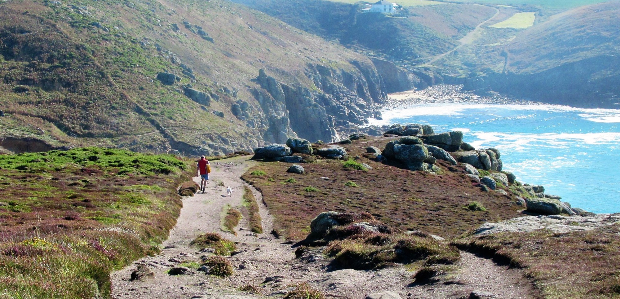
The information below should give you a good idea of the terrain encountered in West Cornwall and help you find your perfect hike. If you are uncertain, we recommend choosing a Category A (shorter daily distances) hike.
Every one has their own idea of what is moderate, easy or difficult and what is easy for one person can be difficult for the next. Likewise different people hike at different speeds, some take more frequent breaks than others and only you know your limits. It is very rare that our customers wish they had chosen longer daily hikes…
In general, the coast path is much more demanding and time consuming than hill walking and allowing for time to stop and enjoy the scenery, a 10 mile hike takes five hours. Please note that this is a generalisation and we have clients who complete the seven miles St Ives to Zennor hike in three hours where as others take six hours.

There can be few trails that include such varying terrain and scenery as the South West Coast Path. From the flat and paved Penzance promenade to the boulder fields approaching Zennor, you should be prepared for a little of everything.
Throughout most of West Cornwall the coast path is made of compacted earth, sand and the thin covering of soil and stone that typifies the region. Steps are often cut into the ground but it is rare that you will find a hand rail to support yourself.
The shots below were taken within a 30 minute walk and are typical of the rapidly changing terrain of the South West Coast Path. Take a closer look at the picture on the left and you should see a small figure climbing out of the valley.
The coast path does run close to the cliff edge and if you suffer from dizziness or vertigo, a coast path walking holiday may not be for you. However it is rare in West Cornwall that you will be hiking along high cliffs where there is a sheer drop into the sea. More commonly there is a series of rocky platforms leading down to the sea. The exception to this is on the north coast between Hayle and Perranporth and then Newquay to Padstow where there are some stunning cliffs. The path meanders to within one metre of the cliff tops and usually there is no barrier. However most of the time the path remains two metres or more from the cliff edge.
The South West Coast Path is a natural trail and in order to preserve the natural beauty, signage is minimal. There are discreet signs at most junctions, indicating the different paths that can be taken (but often without labels of where they lead to!).
But there is no need to worry as for much of the way you are walking along the coast, keeping the sea on one side and the land on the other. To help with the less obvious path junctions we provide route notes and 1:25000 OS maps and most walkers find that as they progress along the path they become quite adept at spotting the signs.
Map reading skills are an advantage but with a smart phone/GPS, our route notes and a little common sense you should be fine. If you feel uncomfortable with this and would prefer a hike with regular sign posts, we advise looking for an alternative holiday.
Please note that this is external content and we take no responsibility for the information contained within these clips.
This clip was posted by one of our clients and gives a great overview of the coast path between St Ives (Carbis Bay) and Penzance. Its a really nice video and gives a good idea of what to expect in mid May.
A concise clip of the St Ives to Zennor walk; one of the most difficult sections of the coast path. It looks easy at the start so make sure you watch the entire clip.
Quite a long clip of the area around Lamorna and it clearly shows how rocky the path is here. Closer to Porthcurno there are one or two very steep hills.
This video focuses on Rinsey, just before Porthleven. The path is quite narrow but there are few serious hills and far fewer rocks than further west.
This video shows the latter half of the walk and as you can see it is mostly flat and gorgeous.
Posted by the same person who posted the Hell’s Mouth to Portreath video, this shows the relatively flat and well maintained coast path found along this section of Cornwall’s north coast.
Be the first to receive all the Latest News and Special Offers...